Last weekend my wife, son and I drove out of the city (in a rented car! Luxury!) to see a natural formation that’s unique in the world: The Channelled scablands of central Washington. Great name, huh? For those of you who don’t know about the scablands, Dry Falls and Lake Missoula, here’s a quick ‘n’ dirty explanation: Thirteen thousand years ago during the end of the last ice age, much of Montana was covered by a body of water we now call Lake Missoula. Ice dammed a river valley in Idaho, creating a body of fresh water larger than several of the Great Lakes.
You won’t be surprised to hear that eventually, the ice melted, the water broke through the dam, and the largest flood ever in the history of our planet was unleashed. Over the course of three days, a 300-ft-deep flood raced across Idaho, Washington and into Oregon as it raced to the sea. The effects of this flood are still most prevalent in the central Washington area near Grand Coulee. There was a Nova program that covered this: Mystery of the Megaflood, but it doesn’t appear to be one of the shows they offer for free online. Maybe you can borrow it from the library, like we did.
What this means is that, out in the desert of central WA, are the effects of floods of water writ large. You know the ripples you see in sand when waves flow over them? Well, look at the land formation above this small town:
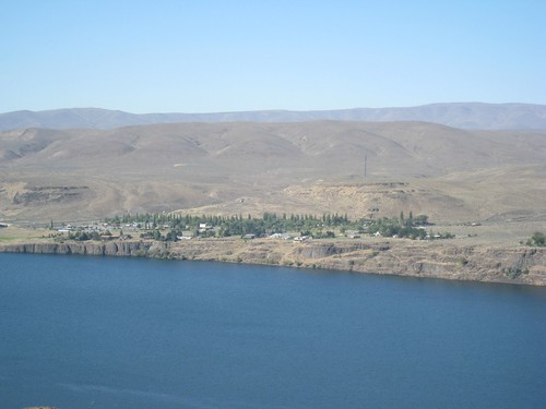
Those gigantic humps are marks of the flood. Crazy, isn’t it?
More below the cut, including Dry Falls, an ice age waterfall ten times larger than Niagra Falls.
The water flooded through here–the falls backed up through this coulee as the flood progressed. In total, the falls moved over 15 miles in the course of a three-day flood:
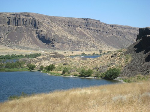
BTW: “coulee” is French for “dry riverbed”.
You can see the marks it left on the land. It also gouged caves under the rocks, and was later enlarged by water and freezing. I’m sorry that the pictures are a little burned out–we took them around the middle of the day when the light was intense.

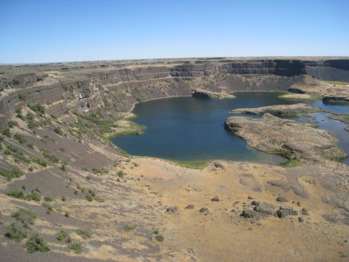
That loose basalt all over the cave depression was everywhere. Eleven million years ago, this same area was scortched by lava welling up through cracks in the earth, killing everything for hundreds of miles. The floods turned it into piles of ankle-twisting rubble and scree.
Here’s a photo of the Dry Falls themselves
And here’s a short video showing a pan and scan of the falls.
My camera can’t really capture the colors, as much as I tried. And there are a couple more photos if you click through to the flickr set.